Jugal Himal: A Hidden Himalayan Paradise of Natural Wonder
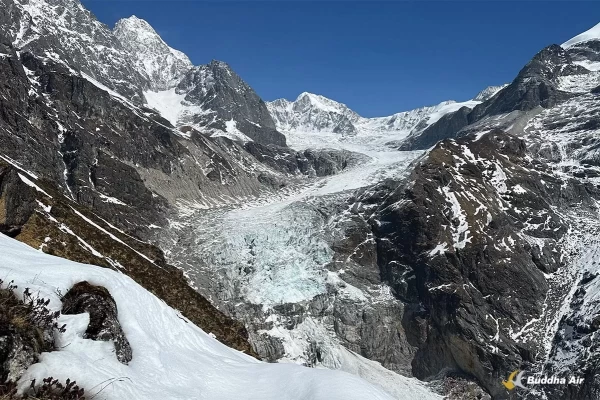
Across the Himalayas, there are a few places resembling “paradise” linked to the great 8th-century Buddhist sage Guru Rinpoche. Known as ‘beyuls,’ they are often located in the most difficult and secluded valleys where the great n Siân Pritchard-Jones n Bob Gibbons Guru meditated. Some are far from Kathmandu, but one such paradise— Jugal Himal—is barely 70km from the capital, hidden in the Himalayan range east of Langtang.
From the rooftops of Kathmandu and Nagarkot, the snow peaks of Jugal Himal, Dorje Lhakpa, Ganchenpo, and Phurbichyachu sparkle in the morning light, offering a glimpse of paradise. Few trekkers have penetrated the pristine forests and wild uplands of Jugal Himal. Only those prepared to camp and endure some discomfort can lay eyes on the untouched pastures, rugged ridges, crags, and icefields bordering Tibet. Easily overlooked by visitors to Nepal, as new dirt roads push ever further, Jugal Himal will become a ‘sought after’ destination for wilderness seekers, trekkers, and especially climbers.
Travelling east from Kathmandu, the good road ends at Balephi before the Chinese-Tibetan frontier at Kodari. In a deeply entrenched Balephi khola valley, the Balephi River runs north through the growing settlements of Jalbire and Katike on a rough and sometimes exposed dirt road. Climbing higher past new hydro projects, the road skirts below Kyangsing and Gumba villages into ever-more stupendous gorges, where sunlight barely penetrates. The wild ride continues up the seemingly impossible hairpin bends to the isolated Sherpa village of Tempathang (2160m). Few Sherpas live in the balephi khola valley, but some crossed high passes decades ago from the adjacent Rolwaling valley.
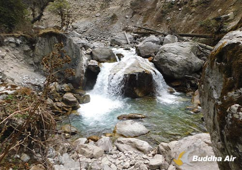
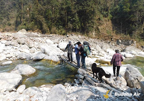
As recently as March 2024, the dirt road was opened as far as Dippu (2235m), the last settlement in the valley. From here, it’s all up through wild forests and herders’ kharkas to the Abode of the Gods. With hydro projects being planned here, the first day’s trail is very poorly maintained. The western side of the valley hosts the main route, but it’s far from easy, with landslides, rocky riverbanks, and some exposure. The alternative trail across the river is equally torrid with more landslides, but there are two significant cave shrines and an isolated settlement at Dojam.
After a morning of toiling up and down streams and landslides, helped by our regular guide Sanjib Gurung, lunch at Chidakpu Kharka is a welcoming sight. Already, our great crew of Pasang (cook), Nima, and Subha has made a hot brew, and we are grateful for the relaxing repose. High above, the contorted ridges of Panch Pokhari are already hinting at the views to come— anticipation is as high as the piles of rice on the crew’s lunch plates.
The river here is not about to give us an easy ride – the banks are steep and loose, with only a flimsy log bridge to cross the angry torrent that drains from the Tilman Pass. Our trail turns away from this domain of demons and cuts northeast. This valley is a little more accessible, with landslides and trees discarded like matchsticks in the riverbed by seasons of heavy flooding. Gingerly, the trail climbs a tricky landslide area to the fabulous meadow of Chhedang Gompa, where a glorious campsite offers the first enticing view of Phurbichyachu. The monastery here once served exiled Tibetan communities, but it’s a sad, neglected place now.
The morning brings glorious views and a better trail, with long stages of well-built stone steps through beguiling forest. Sunlight cloaks the meadows of the isolated kharka of Nimala with much-needed warmth. Views ahead are sensational; the little-known but stately peak of Bhairab Takura appears, flanked to its east by Jugal II and Jugal III. Bhairab is a well-known demoniclooking deity of Kathmandu Durbar Square. The eerie forest wonderland is dominated by towering moss-covered trees –Rhododendron, Hemlock, and Damodar Cedar.
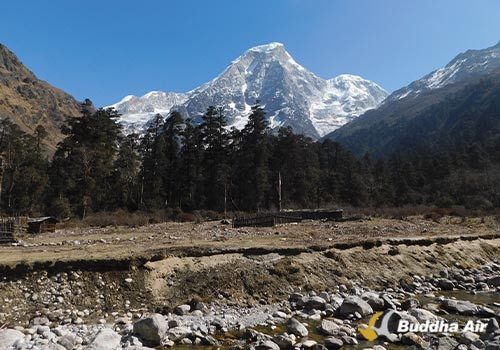
Chejing Kharka (3007m) is our lunch place; the soaring canopy of massive trees retreats for a few square meters to give us a welcoming respite in the sun. The trail mixes old and new, often endless stepped stairways to heaven. It’s a steeper forest stage upwards to the Rakhta (Ganji) Khola canyon that drains from Dorje Lhakpa. The icefields and the peaks remain unseen, but the wild river lets us know that the power of nature is close at hand. There is just one rough space and a cave overhang here at Riverside (3100m) to spend the night. It’s not ideal, but the altitude gains make this the best option– the raging river is noisy, and sleep is a luxury.
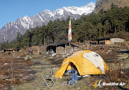
The steep trail climbs onwards below massive landslides that drape the southern buttresses of the Jugal sentinels (Jugal III, II, and I), which run north to the Tibetan border. Towering trees shade the path even at this altitude, as the route negotiates two steep, narrow ravines. Tongsyup Cave is a big attraction, with a massive overhang hiding deities and secretive statues. Folklore suggests this cave once housed a thousand Tibetans seeking safety in days gone by. After a final ascent, the trail levels to reveal the open meadows of Ne Pemasal (3500m) – the ‘beyul’ of the great sage. The shoulder of Phurbichyachu is fleetingly on view, but this paradise camp has no view of the great peak.
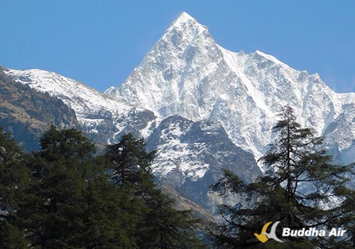
For that, one must walk 20 minutes further via a bridge across the river and skirt fallen trees to the fabulous meadow of Thaldar Thang Kharka, where the full glory of Phurbichyachu is overwhelming. Its gashed buttresses soar to the sky with tall moss-draped Hemlock trees in the foreground. The mountain has a curious name, and debate rages about its meaning. Locally, it’s deemed the strange chicken peak, which hardly befits the stunning setting. Some might call it the ‘Funky Chicken Peak’.
You may also read: Sacred Mountains of Nepal: Pilgrimage Sites and Its Significance
Paradise, the main objective for most trekkers, has already been attained at Ne Pemasal and Thaldar Thang, but few will want to miss the treasures that lie above. That said, it’s not an easy prospect to reach the heart of the elusive Jugal Himal peaks.
The obvious higher trekking viewpoint is the trail that climbs from Ne Pemasal to the stone hut at Bumbaserpu (4200m). It’s a spectacularly steep new trail, but with this excessive altitude gain, most will need a day or two to acclimatize beforehand. This trail then climbs along the ridges from Bumbaserpu to Gyap Kharka (4400m), where the trail ends suddenly at a cliff. This viewpoint has the best panoramic vista of the Jugal Glacier, with Gyalzen Peak to the north, Jugal II and Jugal III to the west, and Phurbichyachu, Jugal Yangri and Ladies Peak to the east.
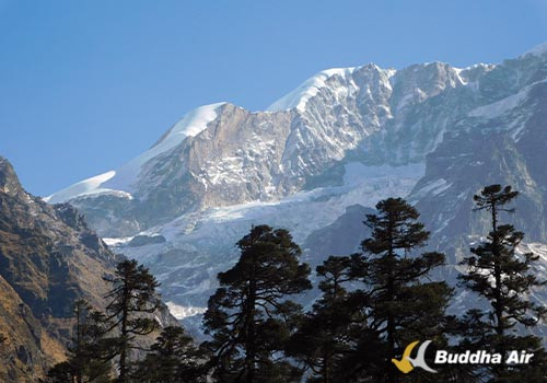
Virtually all the cirques of peaks above the Jugal Glacier and Base Camp are virgin summits; such is the difficulty to approach here – meaning great opportunities for climbers. Amazingly, an expedition came to this wild and untamed region in 1955 when three incredible women, climbers Monica Jackson, Elizabeth Stark, and Evelyn Camrass, sought high adventure on a low budget. Maybe they also wanted to prove that women as well as men could climb virgin Himalayan peaks not long after Tenzing and Hillary’s conquest of Everest in 1953. These three women negotiated the Jugal Glacier Icefall and climbed the upper snowfields to the summit of Gyalzen Peak (6151m), which they named after their Sherpa guide. Today, this is the only more accessible summit in the whole region. The Jugal Peaks, Bhairab Takura, Gumba Chuli, Phurbichyachu, and Langpogang (7083m), the highest, remain extremely forbidding even to seasoned climbers.
Perhaps the true spirit of the enchanting Jugal Himal ‘beyul’ will only be offered to such adventurers. It remains wild, rugged, pristine, hidden, and secretive—a paradise not just for Guru Rinpoche but also for trekkers and climbers alike.
